Touring Skye Without a Car
As an American who grew up in a semi-rural area, car ownership always seemed like an absolute necessity to me. While the UK still has a strong car culture, it's not so endemic that the government forgot about those who don't want a car or can't afford one. There are strong rail links to even small towns, reliable regional buses, multiple taxi services that operate in the middle of nowhere, and generally pedestrian-friendly infrastructure.
Sometimes, though, a car would be nice.
Consider the Isle of Skye. Its narrow winding roads will lead you to some natural features that are downright magical (Fairy Pools, anyone?). The problem - and it's a good problem to have - is that there are so many places you will want to stop that a car quickly becomes the best option for touring the island. What if you're like me and waited way too long to book a car during a surge in domestic tourism brought on by Covid? Well, you find a way.
This is touring Skye without a car.


From Oban to Fort William
Scotland has a robust regional bus system that makes remote regions like the Highlands and the Hebrides accessible to anyone. You can purchase tickets as you get on, but I highly recommend booking them in advance to prevent any unexpected complications that might ruin your timetable. You can simply show the booking email to the driver when you get on. For reference, you would use these bus services to make this same trip:
West Coast Motors (Oban to Fort William): https://www.westcoastmotors.co.uk/
Scottish Citylink (Fort William to Portree): https://www.citylink.co.uk/
Stagecoach (travel around Skye): https://www.stagecoachbus.com/
From our home base in the lovely coastal town of Oban, we took the morning 918 West Coast Motors bus from Oban Station to Fort William. The jaw-dropping scenery of Ben Nevis and surrounding peaks will make the hour and a half go by in a flash. Once you arrive, you can stick around for an hour and a bit to catch the Scottish Citylink bus to Portree, the largest town on Skye, and the likely location of your accommodation.
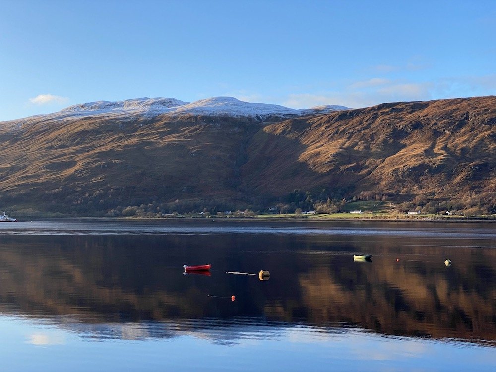
You might consider staying in Fort William for at least a day if you have time. It's a gorgeous town with Loch Linnhe to the west and Ben Nevis to the east. Linnhe is a sea loch, which is essentially the Scottish version of a fjord. These stark, mountainous fjords with a light dusting of snow awakened strong memories of Iceland, so much so that you'd be forgiven for mistaking this region of the UK for somewhere more Nordic. If you arrive in the morning as we did and have an evening to spare, there's a chance you could tackle Ben Nevis, the UK's highest peak, if you're fit enough and willing to hike at a brisk pace.


From Fort William to Portree
After grabbing a lovely vegan breakfast and some coffees to go from The Wildcat cafe, we jumped on Citylink's morning bus to Portree. This ride is a bit longer at 3 hours, but you'll hardly get bored staring out your window. On this journey, you'll cross six lochs and pass beneath the shadow of some of the most impressive peaks in the Highlands, including Sgùrr Fhuaran, Beinn Fhada, and Sgùrr na Ciste Duibhe. Yeah, I'm not 100% sure about the pronunciation either. If you're in Scotland to enjoy the outdoors, (why wouldn't you be) then it's useful to keep in mind that all of these peaks are in the Munro classification - any mountain in Scotland higher than 3,000 ft (914.4 m).
“As Portree came into view, the colorful Easter egg palette of the town's buildings seemed to contradict the reality of Skye's rugged isolation.”
The bus will make a stop in Kyle of Lochalsh - yes, that's the name of a village - just before you cross the bridge to the Isle of Skye. If you're as lucky as I was, you might spot an otter floating on its back, getting a stealthy look at the tourists milling about. Once you're over the bridge, you'll still have an hour of travel time before reaching Portree. We didn't complain much while admiring the jagged profile of the majestic Cuillin ridge, which dominates the backdrop from most vantage points on the southeastern portion of the island. As Portree came into view, the colorful Easter egg palette of the town's buildings seemed to contradict the reality of Skye's rugged isolation.
A brief note about buses on the Isle of Skye
Now, here's where things get a little tricky. There is a Stagecoach bus route (57) that does a loop around the northern half of the island. The 57A travels anticlockwise toward the Old Man of Storr while the 57C runs clockwise via Uig. If you time it just right, you can complete two of the most spectacular day hikes on Skye and be back in Portree in time for dinner. The exact times we used are not so important now since Stagecoach (and really all buses) were operating on an extremely limited schedule due to Covid-19 at the time. There are only 10,000 full-time residents of Skye, so the bus schedule also fluctuates depending on the peak tourist season as well as when school is in session. This post is just a proof of concept based on our experience. Be sure to drop in and visit the friendly folks at the Portree VisitScotland iCentre upon arrival - they will set you right!


Taking the bus to meet the Old Man
We got up at the ass crack of dawn for one of the few 57C buses that were running that day. Unfortunately for us, there was no 57A that morning, which meant we would have to ride in the opposite direction for nearly the full route to get to our first destination: the Old Man of Storr. One might say our journey to one of the most iconic geological features in Scotland got off to a rocky start...sorry, I had to.
Our bus driver was new. As we slowly inched up the steep road from Uig, still sleepy in the pale winter dawn, the driver got stuck on the shoulder of the road while navigating a very sharp hairpin turn. I couldn't be mad - there are a million things I'd rather do than navigate the narrow hilly roads of Skye in a 15-ton vehicle. The more experienced trainer did some impressive maneuvering, rocking us back and forth and giving it some gas to finally free us from the curb.
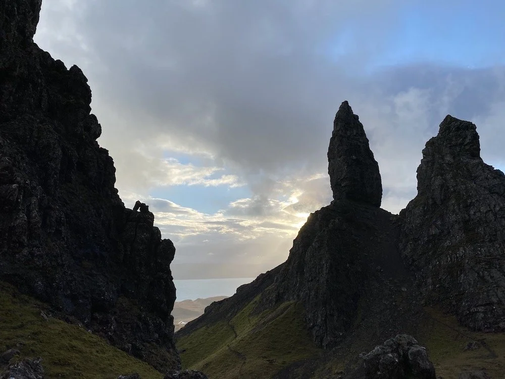
Good thing, too. If he hadn't unbeached us soon, the day would have been over before the sun was barely up due to the limited bus schedule that day. Instead, we were staring up at the imposing basalt barbs of Storr an hour later. We had roughly 3 hours to complete the 2.75-mile hike, which was plenty, but one could easily lose track once they reach the top. The cathedral of sharp stone columns almost feels threatening, probably because it is. They're moving. The formations that shape Storr detached from nearby Trotternish Ridge about 11,500 years ago and have been advancing a few millimeters toward the sea every year. The rockfall is unstable. We could almost feel that potential energy building up as we scarfed down our sandwiches among the boulders. Fortunately for us, the Old Man was not as restless as the wind that day.


Hopping back on to visit his Brother
The wind really did not mess around. Back down at the car park, we spent a while finding the best position to brace against the constant gale until the same driver from earlier rescued us. He only had to travel a few miles up the road to our next destination, but the few minutes out of the wind gave us a much-needed shot of energy for the next hike.
“I jumped over a stream only to land about ankle-deep in the bog on the other side. That's adventure!”
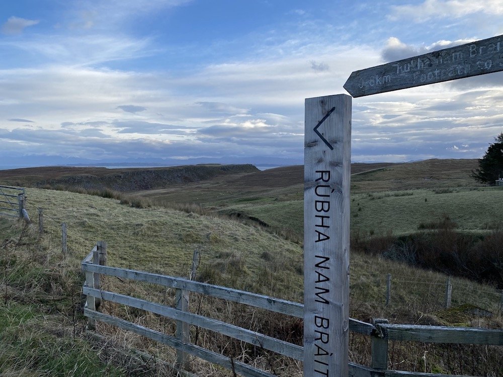
The trailhead for Brother's Point, or Rubha nam Brathairean if you want to get local, is a bit more tucked away than Storr. The closest listed stop on the bus timetable is Grealin Junction, but the driver will likely drop you right in front of the trail if you mention Brother's Point. After finding the wooden sign marking the walk at the top of a gravel path, we passed a couple of B&Bs and arrived at a cattle gate. Beyond this point, here be mud. We may or may not have had a couple of close calls while getting the gate open.
This walk was about as true a Hebridean experience as one could hope for. Sheep roamed free on the green hills that sloped downward toward seaside cliffs. Once we reached the rocky shore strewn with kelp (which the sheep seemed to enjoy), the path to the steep, rocky headland became a matter of guesswork. I jumped over a stream only to land about ankle-deep in the bog on the other side. That's adventure! We waded out of the bog and onto a narrow and slippery path cut into the cliff edge that led us to Brother's Point. The wind continued to batter us, so we avoided walking the precarious ridgeline with sheer drops on either side. Falling off the cliff would have brought down the mood created by the crashing waves, cliffside waterfalls, and peaceful isolation disturbed only by the occasional bleating sheep.
Back in town in time for dinner
Gingerly stepping around narrow, muddy cliff edges takes a lot out of you. Thanks to the expert-level planning of my partner, we had a good half hour to kill while waiting for the bus - just enough time for a cup of tea and eating any remaining morsel we could find in our packs. The junior driver from this morning once again greeted us with a big smile. It was nice to see he had his confidence back. Although Portree was just down the road, we would have to take this route (57A) in the opposite direction, once again navigating the switchbacks where we got stuck. He was a quick study. The bus eased downhill around the precarious turns with no trouble at all.
With that bit of excitement behind us, all of that time out in the wind and walking uphill got the better of me. I nodded off and on throughout the journey back to Portree, occasionally shaken awake to see the sky shifting from blue to orange to black as the long day ended. We had to exchange a high-five or two after engineering such a productive travel day in an isolated place like Skye without a car. If I'm honest, there was one thing on my mind when I had both feet planted in Portree Square again.
"What's for dinner?" ◉
Written by Seth Barham